
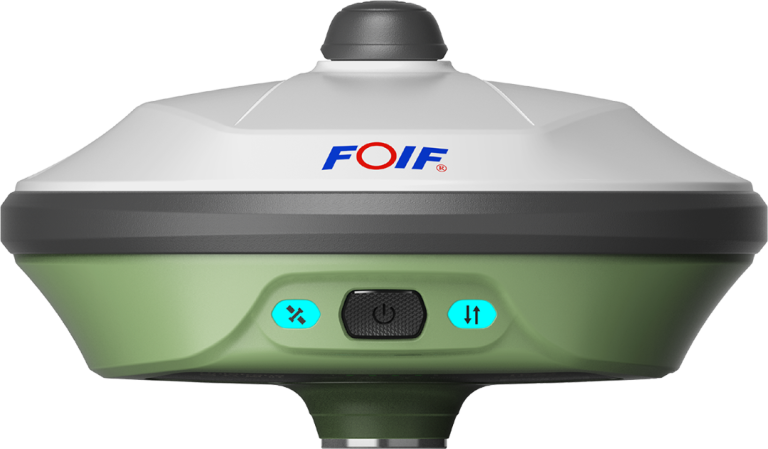
FOIF
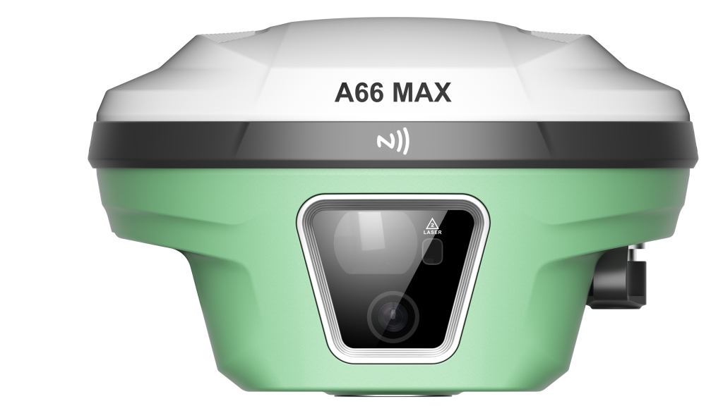
A66MAX GNSS Receiver
Dual-camera efficiency, laser breakthroughThe A66MAX is a laser dual-camera RTK product, supporting BDS/GPS/GLONASS/Galileo/QZSS full-system, full-frequency high-precision positioning. It integrates visible laser, visual imaging, and IMU inertial ...
- G1, G2, G3
- GLONASS
- L5
- NavIC
- L1C/A
- SBAS
Original FOIF unit·Authorized distributor
Overview
About the A66MAX
Specifications
The A66MAX is a laser dual-camera RTK product, supporting BDS/GPS/GLONASS/Galileo/QZSS full-system, full-frequency high-precision positioning. It integrates visible laser, visual imaging, and IMU inertial modules, with the crosshair dynamically aligning the measuring spot for assisted aiming, combined with front and bottom HD cameras and IMU seamless inertial navigation, making measurement all-encompassing!
Dangerous Areas: In some hazardous areas, such as high-voltage towers or utility poles, laser measurements can avoid danger by measuring target points directly from a safe distance.
Cultural Relics: Pavilions, eaves, and other parts of cultural relics are not allowed to be approached; laser measurement can reach the measurement points directly, expanding the scope of measurements.
Bridge Piers and Bridges: Unreachable heights, such as bridge piers, bridges, or walls, can be precisely measured using laser combined with inertial navigation.
Multiplanar Intersection: Laser measurement supports multiplanar intersection measurement, which can further improve the accuracy of laser measurement points.
Specifications
Technical data
Values from the FOIF datasheet. Ask us for the full sheet or a side by side with another model.
Download datasheet (PDF)- 1. Number of channels
- no less than 1408 channels
- 2. Satellite tracking features
- full constellation full frequency reception
- BDS
- B1I, B2I, B3I, B1C, B2a, B2b
- GPS
- L1C/A, L1C, L2C, L2P(Y), L5
- GLONASS
- G1, G2, G3
- Galileo
- E1, E5a, E5b, E6
- QZSS
- L1C/A, L1C, L2C, L5, L6
- NavIC
- L5
- SBAS
- L1C/A
- PPP
- B2B-PPP / E6-HAS
3. Accuracy specifications
- Static
- horizontal ≤2.5mm 0.5ppm, vertical ≤5mm 0.5ppm;
- RTK
- horizontal ≤8mm 1ppm, vertical ≤15mm 1ppm;
- Laser measurement accuracy
- ≤2.5cm (5m), ≤5cm (10m);
- 4. New combined antenna design
- GNSS, WIFI, Bluetooth, 4G antennas integrated, ensuring a cleaner electromagnetic environment inside the receiver;
- 6. Data security
- Supports triple backup for RTK measurement data on the main unit, field book, and cloud. Field survey data can automatically generate a backup on the RTK main unit, allowing recovery from the receiver or cloud if the field book encounters issues.
- 7. Integrated transceiver radio
- The main unit has a built-in 410-470MHz full-band integrated transceiver, compatible with mainstream RTK products with all-direction and multi-protocol support.
- 8. Network
- Comes with an IoT SIM card offering three years of free data. Supports 2G/3G/4G networks from China Mobile, China Telecom, and China Unicom.
- 9. Wireless communication
- Requires built-in dual-mode Bluetooth: Bluetooth 2.1 EDR/Bluetooth 4.0 BLE; supports WIFI: 802.11b/g/n and both access point and client modes.
- 10. Main unit
- Full magnesium alloy body, φ140mm*87mm, weight: 1030g.
- 12. Storage
- Onboard 8G, supports MicroSD expansion.
- 14. Operating temperature
- -30℃ — 65℃, storage temperature: -40℃ — 80℃, protection: IP68, humidity: resistant to 99% condensation.
- 15. Fourth-generation tilt measurement system
- IMU inertial navigation module, 6-axis 400Hz dynamic output, tilt measurement technology with no calibration required.
- 16. Dual cameras
- Front camera FOV 83.4°, sensor 2MP, focal length 5m, resolution 1920*1080; bottom camera FOV 83.4°, sensor 2MP, focal length 2m, resolution 1920*1080.
- 17. Laser rangefinder
- Accuracy 2mm, laser class CLASS 2, wavelength 635nm, measurement frequency 20Hz (fast mode), working range 0.1-60m, resolution 1mm.
Downloads
Datasheets and manuals
Free PDFs for the A66MAX. Need a manual in another language? Ask us and we will send it.
- A66MAX GNSS ReceiverEN · PDF · 13.1 MB EN Download
Related
All GNSS RTK receiversView all
Similar GNSS RTK receivers
Get a quote
Get a quote for A66MAX
Tell us how many units and where they ship. An engineer replies with price, lead time and freight within 24 hours.
- Reply within 24 hours
- Original units with serial numbers
- Local coordinate system preset
Reply within 24 h · Original units · Local datum preset