
UniStrong
DPS107/1010 BeiDou Satellite Land Leveling System
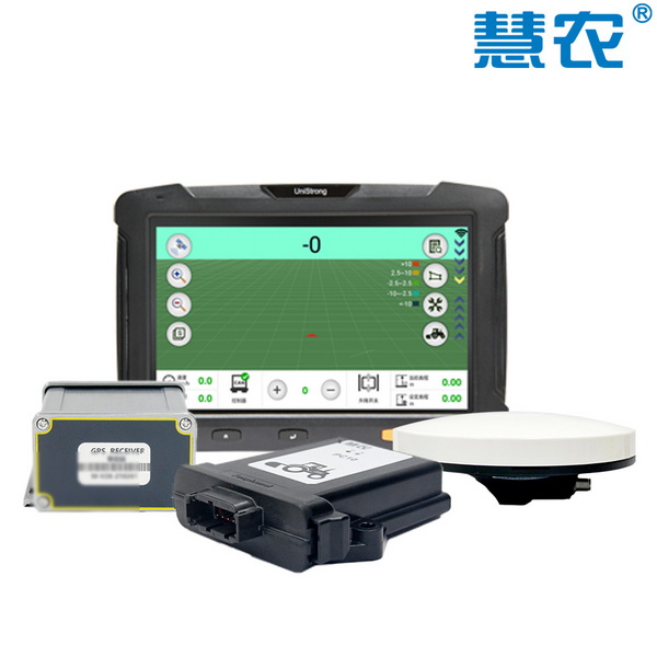
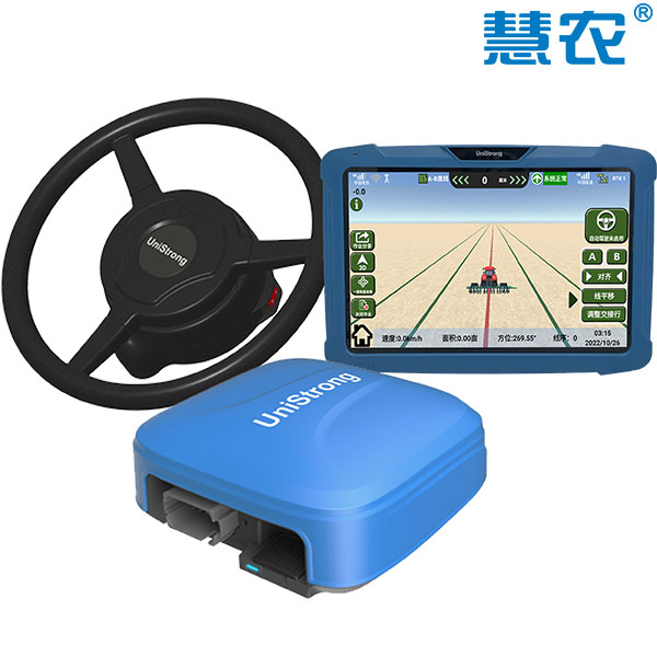
The Huinong® DPS107/1010 BeiDou satellite land leveling system is a high-precision, high-performance system launched by UniStrong, leveraging its technological advantages in BeiDou satellite navigation and positioning. Composed of modules including a GNSS receiver, controller, display terminal, GNSS antenna, and handheld switch, it offers easy installation.
Original UniStrong unit·Authorized distributor
Overview
About the DPS107/1010
The Huinong® DPS107/1010 BeiDou satellite land leveling system is a high-precision, high-performance system launched by UniStrong, leveraging its technological advantages in BeiDou satellite navigation and positioning. Composed of modules including a GNSS receiver, controller, display terminal, GNSS antenna, and handheld switch, it offers easy installation. The system determines the reference elevation of the scraper blade in the current field through high-precision BeiDou positioning and integrates proprietary controller algorithms to regulate the blade's elevation. It significantly improves land leveling efficiency and quality, ensures optimal use of water and fertilizer resources, lowers operational costs, and boosts yields and income.
Product Overview:
The Huinong® DPS107/1010 BeiDou Satellite Land Leveling System is a high-precision, high-performance satellite land leveling system launched by UniStrong, leveraging its technical expertise in BeiDou satellite navigation and positioning. The system consists of modules including a satellite receiver, controller, display, GNSS satellite antenna, and handheld switch, offering easy installation. By utilizing high-precision BeiDou satellite positioning to determine the benchmark elevation of the scraper in the working field, and integrating proprietary controller algorithms, the system controls the elevation of the scraper blade. This greatly improves land leveling efficiency and quality, maximizes water and fertilizer utilization, reduces operational costs, and increases yield and revenue.
Product Features:
1. Optional 7-inch or 10-inch Android display with clear sunlight readability; 2. Modular system design for easy installation; 3. Intuitive interface for easy operation; 4. Supports both flat and sloped land leveling; 5. Flexible choice between network RTK version and UHF radio version; 6. The UHF radio version utilizes a self-developed portable base station with stable satellite tracking; 7. Stable system performance achieving centimeter-level leveling accuracy.
Specifications
Technical data
Values from the UniStrong datasheet. Ask us for the full sheet or a side by side with another model.
- Signal Tracking
- BDS: B1I, B3I, B1C, B2a, B2b, ACEBOC
- Signal Tracking
- GPS: L1C/A, L1C, L1P, L2, L2P, L5
- Signal Tracking
- GLONASS: G1, G2, G3
- Signal Tracking
- Galileo: E1, E5a, E5b, ALTBOC, E6
- Signal Tracking
- QZSS: L1C/A, L1C, L2C, L5, LEX
- Signal Tracking
- SBAS
- Signal Tracking
- L-Band (Commercial PPP Service)
- Positioning Accuracy
- Horizontal: ±8 mm + 1 ppm; Vertical: ±15 mm + 1 ppm
- Land Leveling Accuracy
- ≤3.0 cm
- Operating Temperature
- -20°C to +70°C
Related
All precision agricultureView all
Similar precision agriculture
Get a quote
Get a quote for DPS107/1010
Tell us how many units and where they ship. An engineer replies with price, lead time and freight within 24 hours.
- Reply within 24 hours
- Original units with serial numbers
- Local coordinate system preset
Reply within 24 h · Original units · Local datum preset