
UniStrong
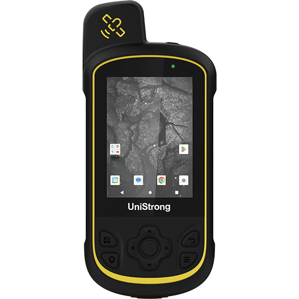
G110BD Professional BeiDou Handheld Land Area Meter
The G110BD features fully graphical real-time data display, long battery life, simple operation, and diverse measurement methods, meeting the needs for area and length measurement and automatic calculation through vertex mode, trajectory mode, equal-width harvesting mode, and slope measurement. It significantly enhances the simplicity and…
- 72
- Channels
- 1Hz
- Update Rate
- 4GB
- Memory
Original UniStrong unit·Authorized distributor
Overview
About the G110BD
The G110BD features fully graphical real-time data display, long battery life, simple operation, and diverse measurement methods, meeting the needs for area and length measurement and automatic calculation through vertex mode, trajectory mode, equal-width harvesting mode, and slope measurement. It significantly enhances the simplicity and operational efficiency of agricultural land acreage measurement. It is currently widely used in harvester area measurement, irregular plot surveying, cross-regional agricultural machinery operations, aquaculture in waters and tidal flats, rural land rights confirmation, grassland rights registration, farmland area measurement, agricultural insurance loss assessment, and many other agricultural applications.
Product Description
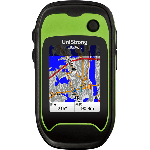
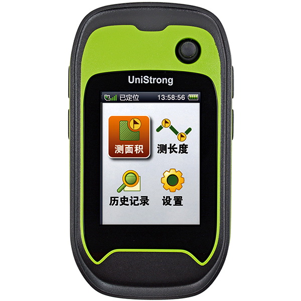
The G110BD features fully graphical real-time data display, long battery life, simple operation, and multiple measurement methods. It meets the requirements for measuring and automatically calculating area and length using methods such as vertex method, track method, equal-width harvesting method, and slope measurement. It significantly enhances the simplicity and operational efficiency of farmland acreage measurement. It is widely used in various agricultural applications, including harvester area measurement, irregular plot survey, cross-regional agricultural machinery operations, aquaculture in water bodies and tidal flats, rural land rights confirmation, grassland rights registration, farmland area survey, and agricultural insurance claim assessment.
G110BD BeiDou + GPS + GLONASS Professional Land Area Meter
● BeiDou / GPS / GLONASS satellite reception ● Three power supply modes: dry battery, lithium battery, and USB ● Industrial rugged design, durable and robust ● Multiple measurement methods ● Simple and easy to operate
G110BD Product Features
● Three Major Satellite Constellations: BeiDou / GPS / GLONASS The G110BD supports BeiDou, GPS, and GLONASS satellite constellations, providing high positioning accuracy and fast speed, achieving superior positioning results in obstructed environments. ● Flexible Switching Between Three Power Supply Modes Seamlessly switch among dry battery, lithium battery, and USB power modes to meet power demands in various working environments and effectively reduce consumable costs. ● Industrial Rugged Design Featuring an IP67 protection rating and 1.5 m natural drop resistance, it withstands harsh outdoor field environments while remaining compact and portable. ● High-Capacity Storage Space 4 GB internal storage to meet massive data logging needs. ● Professional Display Configuration 2.4-inch TFT color screen, clearly readable in bright sunlight; 240×320 pixels for crisp and detailed graphic display, with adjustable screen backlight.
In addition to traditional track and vertex area measurement methods, an equal-width harvesting method is included, allowing users to customize harvesting width. Beyond powerful area calculation, it also supports length measurement and slope area measurement. 2. Graphical Measurement Data Whether during data collection or browsing stored data, information is displayed graphically for intuitive viewing. 3. Professional Workflow Design The UI sequence is designed strictly following user workflows, ensuring smooth and effortless operation. 4. User-Friendly Interface Design All screens feature large fonts and intuitive icons, making it easy to understand product functions and master operating procedures. 5. Thoughtful Operation Prompts to Minimize User Errors Clear prompts are provided for actions involving deletion or canceling data collection, preventing accidental data loss. 6. Multiple Unit Options and Automatic Total Price Calculation Built-in common length and area units. Users can set a unit price per area to automatically calculate total cost without manual recalculation, reducing manual effort.
Standard Configuration
: ● Main unit ● Mini USB-to-USB cable ● User manual ● Lanyard ● Packaging box (with insert) ● Warranty card ● Certificate of conformity
Specifications
Technical data
Values from the UniStrong datasheet. Ask us for the full sheet or a side by side with another model.
- Satellite Tracking
- BeiDou B1, GPS L1, GLONASS L1, SBAS supported
- Channels
- 72
- Positioning Modes
- GPS / BeiDou / GPS+GLONASS / GPS+BeiDou
- Positioning Accuracy
- Single Point: 2-5m, SBAS: 1-3m
- Update Rate
- 1Hz
- Memory
- 4GB
- Power Supply
- AA battery / Lithium battery / USB
- Battery Life
- AA battery: 8 hours, Lithium battery: 12 hours
- Area Measurement
- Track method, inflection point method, equal-width harvesting method
- Length Measurement
- Track method, feature point method
- Area Modes
- Supports planar measurement and slope measurement
- Area Units
- Mu (mu), square meter (m2), hectare (ha), are (a), big mu (da), acre (ac)
- Screen Size
- 2.4 inches
- Resolution & Type
- 240×320, sunlight-readable TFT
- Dust & Water Protection
- IP67
- Drop Resistance
- Withstands 1.5m drop onto hard surface
- Operating Temperature
- -20℃ ~ +60℃
- Storage Temperature
- -30℃ ~ +70℃
- Dimensions
- 112mm×68mm×37mm
- Buttons
- 5-way joystick key, power key, exit key, collection shortcut key, zoom in/out keys
- Special Features
- Enhanced edition includes UniStrong GIS Office professional software, supporting data export.
Related
All controllers and GISView all
Similar controllers and GIS
Get a quote
Get a quote for G110BD
Tell us how many units and where they ship. An engineer replies with price, lead time and freight within 24 hours.
- Reply within 24 hours
- Original units with serial numbers
- Local coordinate system preset
Reply within 24 h · Original units · Local datum preset