
UniStrong
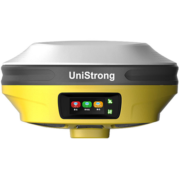
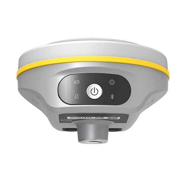
G20 Visual Surveying GNSS Receiver
The G20 is a fully featured GNSS receiver integrating IMU, video, and surveying RTK. Equipped with a high-performance, high-precision satellite positioning OEM board, it supports full-constellation and full-frequency GNSS signal processing.
- 400 Hz
- IMU Update Rate
- 2 MP
- Resolution
- 2–4 cm
- Measurement Accuracy
Original UniStrong unit·Authorized distributor
Overview
About the G20
The G20 is a fully featured GNSS receiver integrating IMU, video, and surveying RTK. Equipped with a high-performance, high-precision satellite positioning OEM board, it supports full-constellation and full-frequency GNSS signal processing. It features narrowband anti-interference technology and automatic ionospheric mitigation to meet surveying demands in challenging environments. Combining RTK with imagery, it enables one-step visual real-scene stakeout. The newly added visual measurement feature effectively extends coordinate positioning and broadens operational reach. Pre-installed with fourth-generation IMU tilt compensation technology, it allows immediate measurement without leveling, enabling continuous stakeout on the go.
Specifications
The G20 is a full-featured GNSS receiver integrating IMU tilt compensation, video, and surveying RTK. Equipped with a high-performance, high-precision GNSS positioning OEM board, it supports all-constellation, all-frequency GNSS signal processing. It features narrowband anti-interference technology and automatic ionospheric optimization to meet surveying demands in complex environments. Combining RTK with imaging enables real-scene stakeout in one step. The newly added video measurement function effectively extends point coordinates and expands the operational range. Pre-installed with 4th-generation IMU tilt compensation technology, it measures as soon as the pole is lifted, enabling walking stakeout.
Stable Signal
: Supports narrowband anti-interference technology with automatic ionospheric optimization, actively detecting and effectively suppressing internal and external interference signals. Three Years of Free Cellular Data: Comes with an IoT SIM card for instant surveying upon boot-up with three years of free cellular data. Worry-Free Battery Life: Built-in dual smart lithium batteries meet the requirements of 16 hours of daily operations. The Type-C port supports PD fast charging and power bank power supply for uninterrupted work. One-Click Fixed: One-click configuration for nationwide CORS differential services achieves a fixed solution upon power-up, supporting direct surveying in CGCS2000 and various other coordinate systems. Industrial-Grade Protection: IP67-rated protection provides comprehensive protection even under prolonged water immersion. Dual Data Backup: Survey data supports dual backup to both the data controller and receiver, ensuring double data security.
All-Constellation All-Frequency ・ Fast Locking
Equipped with a high-performance, high-precision GNSS SoC OEM board, ensuring signal reception quality while supporting all-constellation, all-frequency GNSS satellite signals including BeiDou, GPS, GLONASS, Galileo, and QZSS, enabling rapid acquisition, tracking, and processing of GNSS satellite signals.
Video Measurement ・ Expanded Operational Range
After RTK collects base point information, even when impassable obstacles exist, point coordinates can be effectively extended to expand the operational range. Application scenarios are as follows:
Real-Scene Stakeout ・ In One Step
GNSS + IMU + visual fusion algorithms significantly mitigate the impact of electromagnetic interference, delivering precise stakeout. RTK combined with imagery marks stakeout points directly on the real-world view for quick point locating in one step. Dual AR imagery on both the data controller and the receiver provides intelligent guidance throughout the entire stakeout process, doubling operational efficiency.
Specifications
Technical data
Values from the UniStrong datasheet. Ask us for the full sheet or a side by side with another model.
Tracking Characteristics
- GPS
- L1 C/A, L1C, L2P (Y), L2C, L5
- GLONASS
- G1, G2, G3
- BDS
- B1I, B2I, B3I, B1C, B2a, B2b
- Galileo
- E1, E5a, E5b, E6
- QZSS
- L1, L2, L5
- Survey Resume after Power Off
- Supported
Accuracy Specifications
- Static Horizontal Accuracy
- Horizontal: ±(2.5+0.5×10^-6 D) mm
- Static Vertical Accuracy
- Vertical: ±(5+0.5×10^-6 D) mm
- RTK Horizontal Accuracy
- Horizontal: ±(8+1×10^-6 D) mm
- RTK Vertical Accuracy
- Vertical: ±(15+1×10^-6 D) mm
IMU Tilt Compensation
- Compensation Accuracy
- 8 mm + 0.3 mm/° tilt (<2.5 cm accuracy within 30°)
- Tilt Angle
- 0°–60°
- IMU Update Rate
- 400 Hz
Stakeout Camera
- Resolution
- 2 MP
- FOV
- 72°
Surveying Camera
- Resolution
- 2 MP
- FOV
- 72°
- Frame Rate
- 30 fps
Photogrammetry Accuracy
- Measurement Accuracy
- 2–4 cm
- Operating Distance
- 2–15 m
System Platform
- Operating System
- Industrial-grade Linux OS
- Internal Storage
- Onboard 8 GB storage
- Bluetooth
- Bluetooth 5.0 EDR backward compatible, BLE
- Wi-Fi
- 802.11 a/ac/b/g/n
Data Interfaces
- TNC Interface
- Connects to internal UHF radio antenna
- Type-C
- For direct charging and data transmission
- SIM Card Slot
- SIM card slot
Internal UHF Radio
- Protocols
- Supports full protocols: TrimTalk 450S, TrimTalk(4800), TrimMark III, South (9600, 19200), PCC-GMSK, PCC-4FSK, Satel, Satel_ADL, HITARGET(9600), HITARGET(19200), HZSZ, GEOTALK, GEOMARK, PCCFST, PCCFST_ADL
- Frequency
- 410–470 MHz switchable
- Channels
- 7+2400 (7 fixed channels + 2400 custom channels)
Environmental Specifications
- Operating Temperature
- -30°C to +65°C
- Storage Temperature
- -40°C to +80°C
- Ingress Protection
- IP67
- Drop Resistance
- Withstands 2 m pole drop onto hardwood floor at ambient temperature, 1.2 m free drop
- Humidity
- Resistant to 99.9% condensation
Physical & Electrical Specifications
- Dimensions
- Φ134 mm * 72 mm
- Battery Capacity
- Built-in battery, 3.6 V, 13.6 Ah, 48.96 Wh, supports PD fast charging
- Buttons
- 1 multi-function power button
- Weight
- Approx. 897 g
- Indicators
- Satellite indicator, data link indicator, battery indicator
Physical and Power Specifications
- Display
- 1.1-inch AMOLED display, 294×126 resolution
- Material
- Magnesium alloy housing
Hardware Specifications
- Processor
- Octa-core 2.0 GHz
- RAM
- 3 GB LPDDR4X
- Storage
- 32 GB on-board storage, supports TF card expansion (up to 512 GB)
- Display
- 5.0-inch HD touchscreen
- Battery
- Built-in 3.85 V 6400 mAh lithium battery, operating time > 15 hours
- Keypad
- Alphanumeric multi-function physical keypad
Environmental Specifications
- Ingress Protection
- IP67
- Temperature
- Operating temperature: -30℃ to +60℃; Storage temperature: -40℃ to +80℃
- Drop
- Withstands 2 m pole drop
Data Communications
- Wi-Fi
- 2.4G/5G, 802.11 ac/a/b/g/n wireless LAN
- Bluetooth
- BT2.1+EDR / 3.0 / 4.1LE / 4.2 / 5.0 BLE
- Cellular Network
- 2G: GSM/GPRS/EDGE/CDMA95; 3G: TD-SCDMA/WCDMA/EVDO; 4G: TDD-LTE/FDD-LTE, full Netcom
Operating System
- Operating System
- Android 11
Get a quote
Get a quote for G20
Tell us how many units and where they ship. An engineer replies with price, lead time and freight within 24 hours.
- Reply within 24 hours
- Original units with serial numbers
- Local coordinate system preset
Reply within 24 h · Original units · Local datum preset