
UniStrong
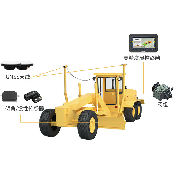
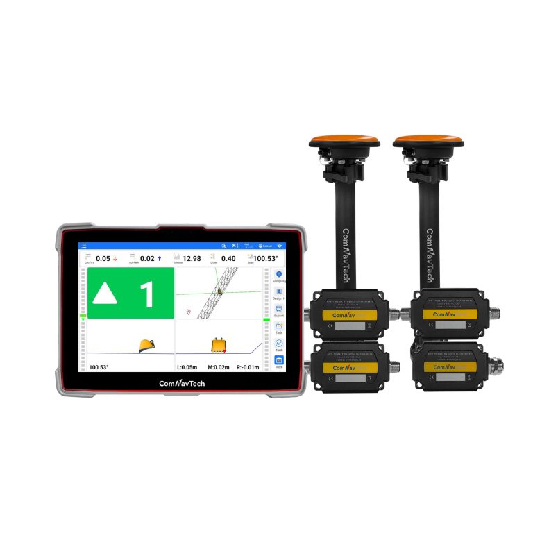
UGS Intelligent Motor Grader Machine Control System
The system utilizes BeiDou/GNSS technology combined with sensors and hydraulic control devices to deliver…
Authorized distributor of original survey instruments·Dispatch in 3 to 7 working days·DDP / CIF / FOB
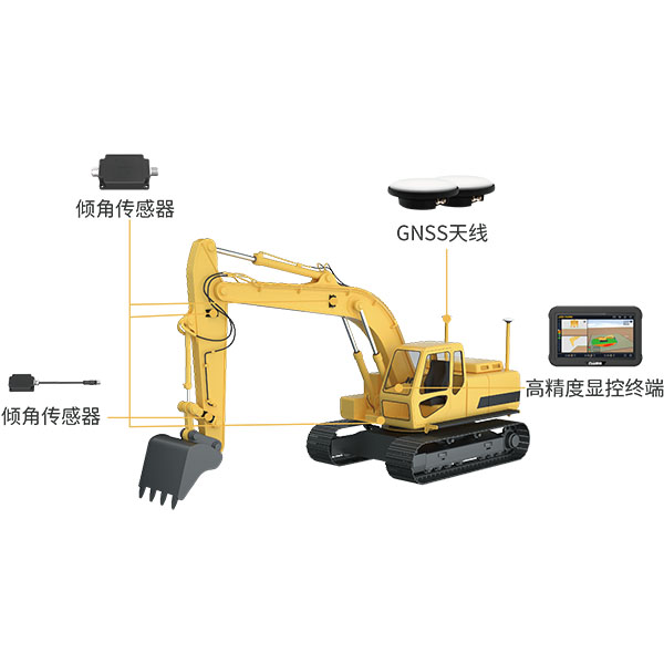
The system utilizes BeiDou/GNSS and multi-sensor fusion technology to provide real-time 3D guidance and automatic control over bucket position and attitude. Using 3D design files as construction benchmarks, it quickly and accurately meets design requirements in environments without manual surveying or stakeout.
Original UniStrong unit·Authorized distributor
The system utilizes BeiDou/GNSS and multi-sensor fusion technology to provide real-time 3D guidance and automatic control over bucket position and attitude. Using 3D design files as construction benchmarks, it quickly and accurately meets design requirements in environments without manual surveying or stakeout. Even less experienced operators can work day and night to accomplish tasks rapidly and accurately, avoiding rework, improving work efficiency, and increasing project profitability.
The system utilizes BeiDou/GNSS and multi-sensor fusion technology to provide real-time 3D guidance and automatic control of bucket position and attitude. Using 3D design files as construction reference, it quickly and accurately meets design requirements in environments without manual surveying or stakeout. Even inexperienced operators can work day and night to complete tasks quickly and precisely, avoiding rework, improving work efficiency, and increasing project returns.
● Cost Reduction & Efficiency: Stakeless construction reduces manual assistance such as surveying and staking, prevents over-excavation and under-excavation, cuts labor costs, and improves construction efficiency. ● Geofencing: Configurable geofences and avoidance zones prevent accidents and liability caused by blind operations, significantly enhancing safety. ● High-Precision Construction: Real-time, precise guidance via graphical and numerical displays delivers accuracy up to ±3 cm, ensuring quality construction even in blind spots beyond the operator's line of sight. ● Remote Monitoring: Enables remote monitoring of construction processes, quality, and progress, with timely deviation alerts for quick corrective action. ● Data Traceability: Full-process data is automatically collected, transferred, and archived digitally, facilitating data retrieval, statistical analysis, and decision support. ● User-Friendly Operation: Features modular function management and an intuitive workflow. Operators can become proficient with minimal training, and the system supports direct import of various design file formats.
Widely used in slope grading, river channel excavation, foundation pit excavation, and proving ground high-speed circuit construction.
Values from the UniStrong datasheet. Ask us for the full sheet or a side by side with another model.
The system utilizes BeiDou/GNSS technology combined with sensors and hydraulic control devices to deliver…
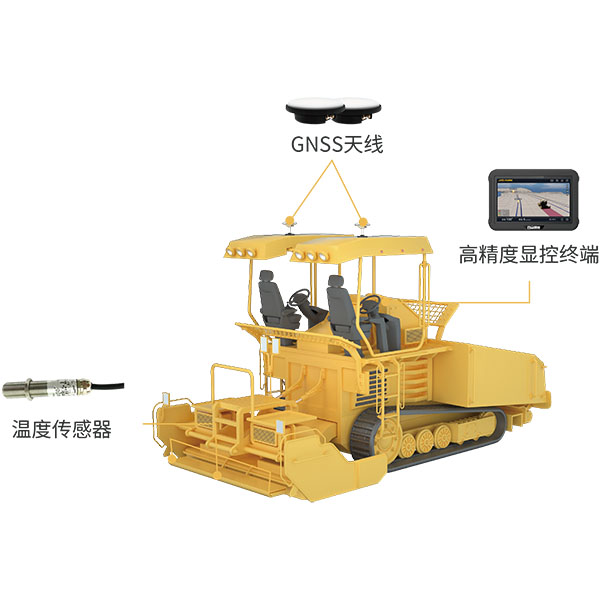
During paving operations, the intelligent paver guidance system utilizes BeiDou/GNSS equipment and infrared temperature…
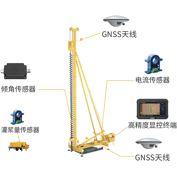
The system utilizes BeiDou/GNSS and multi-sensor fusion technology to obtain precise 3D position information…
Tell us how many units and where they ship. An engineer replies with price, lead time and freight within 24 hours.
Reply within 24 h · Original units · Local datum preset