
KOLIDA
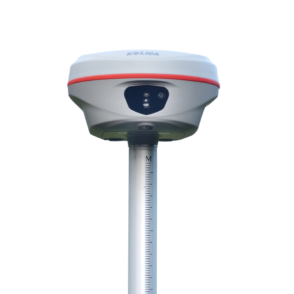
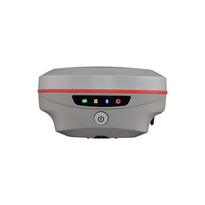
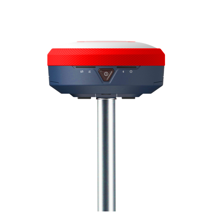
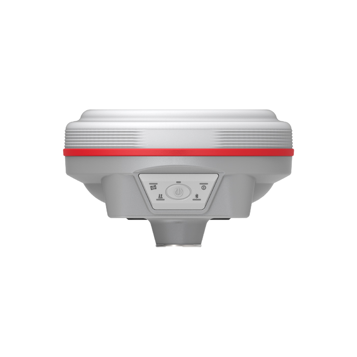
K60 Max Pro
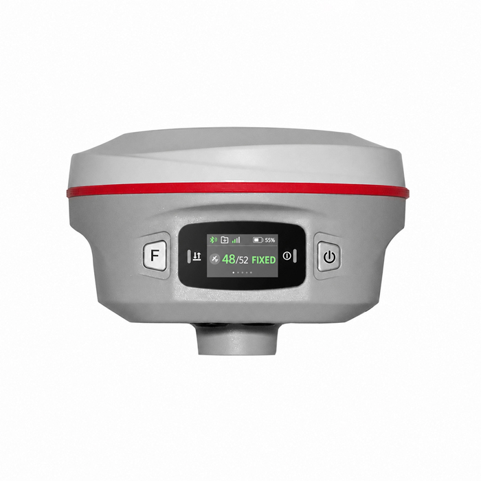
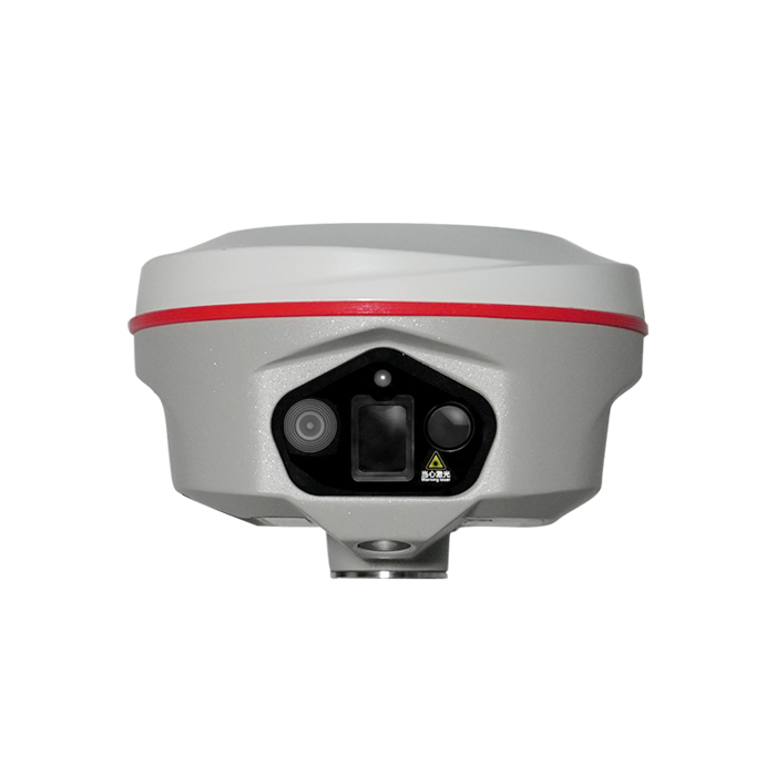
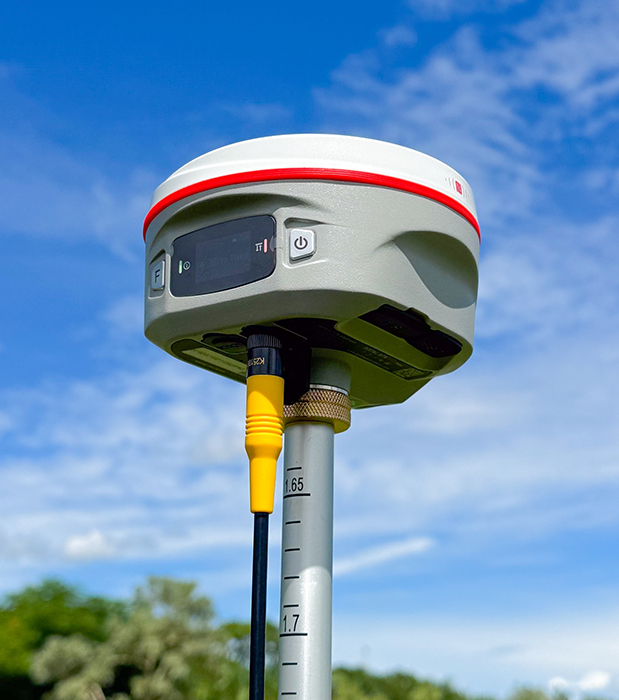
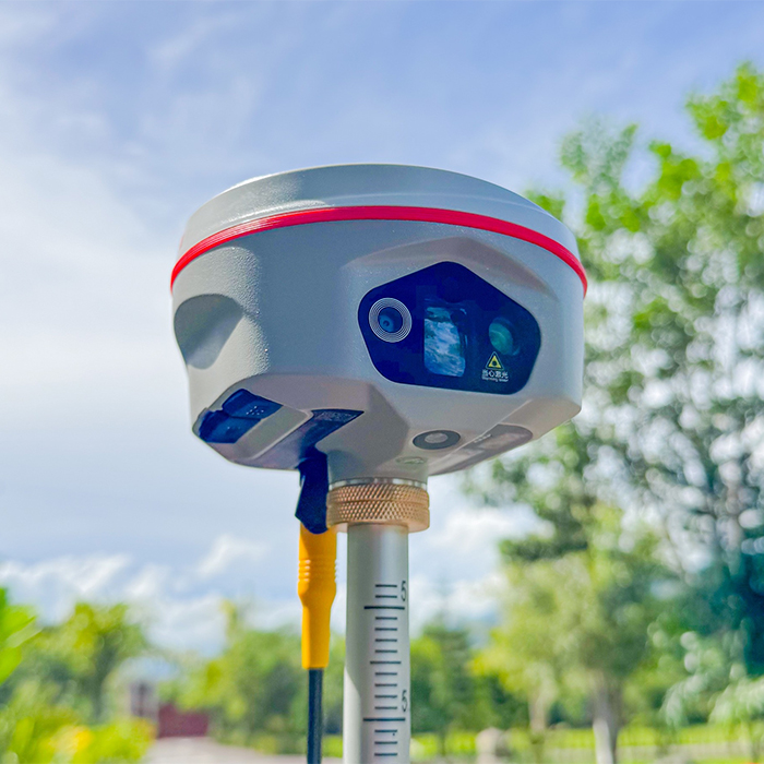
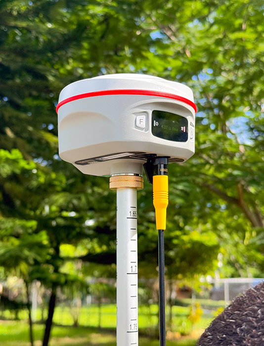
K60 Max Pro integrates 200m laser ranging,400Hz high-speed IMU and triple-camera, delivering high-precision field survey
Original KOLIDA unit·Authorized distributor
Overview
About the K60 Max Pro
- 01
200m Laser Measurment 150m (standard) and up to 200m (optimal conditions)
- 02
The 6th Gen. IMU 400 Hz / 0.05°/ 0.15° easy & smooth workflow
- 03
Triple HD Camera Clear and smooth switch
- 04
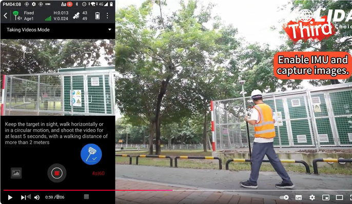
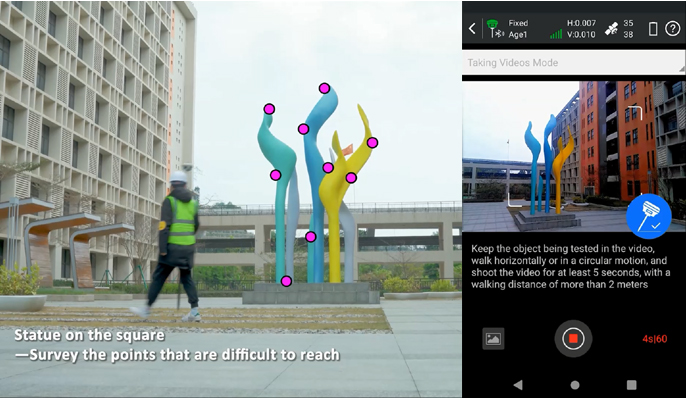
Video Shooting Photogrammetry Positioning
Superior Long-Range Targeting
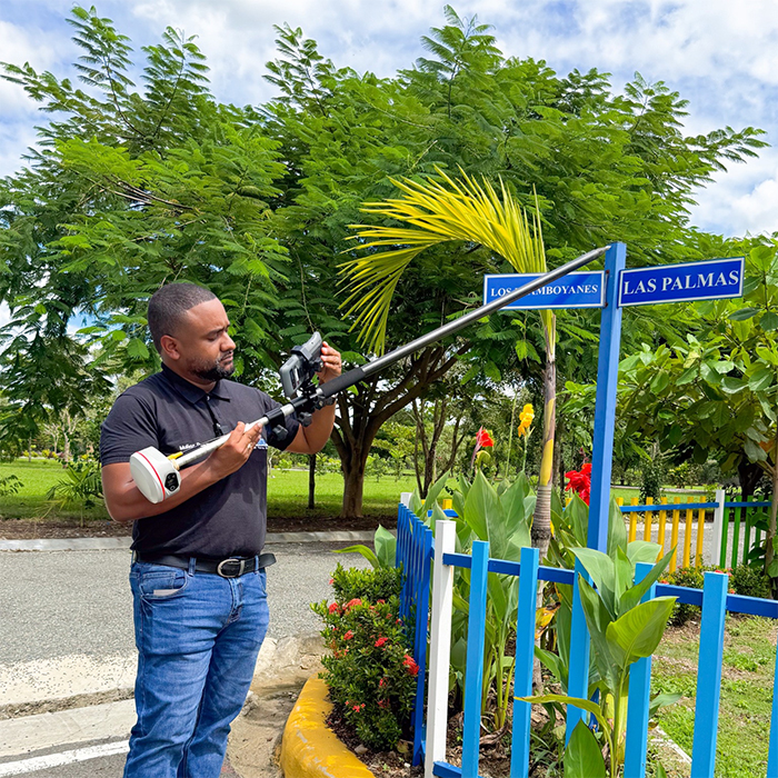
The next-generation laser module boasts a maximum range of 150m (standard conditions) and up to 200m (optimal conditions). Paired with a 25mm telephoto lens, the K60 Max Pro enables clear targeting and precise coordinate measurement even at distances of 15–20 meters, making distant objects feel within reach.
Precision Edge Capture: Efficiency Meets Safety
The K60 Max Pro’s high-precision ±3 to 5 mm + 100 ppm laser beam can capture extrema (minimum/maximum values) while scanning across an object. Whether measuring utility pole edges, tree diameters, or irregular structures, the results are faster and more accurate than previous generations. This capability dramatically boosts efficiency and ensures the surveyor's safety when working in complex or hazardous areas.
Rapid Multi-Target Capture Without Limits
Driven by a 520nm green laser operating at a high-speed 5Hz rate to instantly adapt to different surface reflectivities, the system effortlessly locks onto leaves, metal, or glass in real-time. This exceptional adaptability ensures any material is instantly captured, eliminating measurement failures on difficult or reflective surfaces.
The 6th Gen. IMU
instant activation, rock-solid accuracy Thanks to the high-frequency 400 Hz IMU, Just take a natural step, the IMU is ready instantly, and with the 0.15° heading accuracy caps 20-meter deviations under 5cm to stop coordinate drifting and ensure rock-solid data . It also delivers ultra-stable performance, walk at your pace without worrying about losing IMU.
Specifications
Technical data
Values from the KOLIDA datasheet. Ask us for the full sheet or a side by side with another model.
Download datasheet (PDF)Satellite Tracking Ability
- Channels 1898 channels
- Constellation GPS, GLONASS, BEIDOU, GALILEO, QZSS , SBAS / L-Band BDS PPP & Galileo HAS
- Positioning Output Rate 1-20 HZ
- Initialization Time <10 s
Positioning Precision
- UHF RTK Horizontal ±8mm +1 ppm Vertical ±15mm +1 ppm
- Network RTK Horizontal ±8mm +0.5 ppm Vertical ±15mm +0.5 ppm
- Static and Fast-Static Horizontal ±2.5mm +0.5 ppm Vertical ±5mm +0.5 ppm
- RTK Initial time 2-8s
User Interaction
- Operation System Linux
- Screen Display 1.14’ LED, 135*240 pixel / wifi Yes
- Voice Guide yes, 9 language
- Data Storage 16 GB internal, Support external USB storage (OTG) / Web UI Yes
Working Capability
- Laser 3R green laser, 150m range (200m in optimal condition)
- Camera Video shooting camera: 8MP Laser aiding telephoto camera: 8MP AR stakeout camera: 2MP / IMU calibration-free, up to 120°, refresh rate 400 Hz, pitch & roll accuracy 0.05 °,heading accuracy 0.15°
- Laser Measurement Shooting Laser to measure coordinate & stakeout
- Visual Positioning Shooting photo or video to measure coordinate / 3D Modeling Process by Post-processing software
- Visual Stakeout with AR Uses Dual-Camera to stakeout pts, lines, CAD
- Radio Built-in transmitting and receiving, 1/2 W / Tilt Survey Inertial Measurement
- Endurance up to 16 hours (static mode), up to 12 hours (rover mode), up to 10 hours (UHF base mode)
- OTG (Field Download) yes / Electronic Bubble Yes
Satellite Tracking Ability
- Channels 1898 channels
- Constellation GPS, GLONASS, BEIDOU, GALILEO, QZSS , SBAS / L-Band BDS PPP & Galileo HAS
- Positioning Output Rate 1-20 HZ
- Initialization Time <10 s
Positioning Precision
- UHF RTK Horizontal ±8mm +1 ppm Vertical ±15mm +1 ppm
- Network RTK Horizontal ±8mm +0.5 ppm Vertical ±15mm +0.5 ppm
- Static and Fast-Static Horizontal ±2.5mm +0.5 ppm Vertical ±5mm +0.5 ppm
- RTK Initial time 2-8s
User Interaction
- Operation System Linux
- Screen Display 1.14’ LED, 135*240 pixel / wifi Yes
- Voice Guide yes, 9 language
- Data Storage 16 GB internal, Support external USB storage (OTG) / Web UI Yes
Working Capability
- Laser 3R green laser, 150m range (200m in optimal condition)
- Camera Video shooting camera: 8MP Laser aiding telephoto camera: 8MP AR stakeout camera: 2MP / IMU calibration-free, up to 120°, refresh rate 400 Hz, pitch & roll accuracy 0.05 °,heading accuracy 0.15°
- Laser Measurement Shooting Laser to measure coordinate & stakeout
- Visual Positioning Shooting photo or video to measure coordinate / 3D Modeling Process by Post-processing software
- Visual Stakeout with AR Uses Dual-Camera to stakeout pts, lines, CAD
- Radio Built-in transmitting and receiving, 1/2 W / Tilt Survey Inertial Measurement
- Endurance up to 16 hours (static mode), up to 12 hours (rover mode), up to 10 hours (UHF base mode)
- OTG (Field Download) yes / Electronic Bubble Yes
Videos
See the K60 Max Pro at work
0:11
KOLIDA product video 1
Product video · Official KOLIDA video
Get a quote
Get a quote for K60 Max Pro
Tell us how many units and where they ship. An engineer replies with price, lead time and freight within 24 hours.
- Reply within 24 hours
- Original units with serial numbers
- Local coordinate system preset
Reply within 24 h · Original units · Local datum preset