
UniStrong
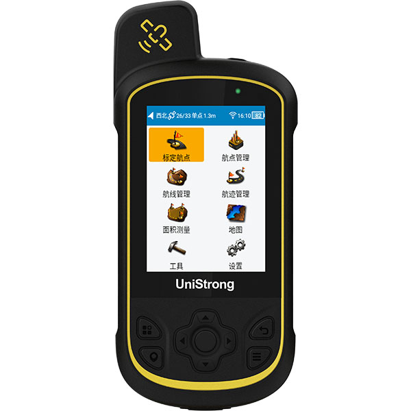
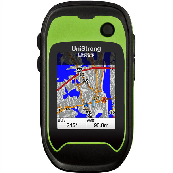
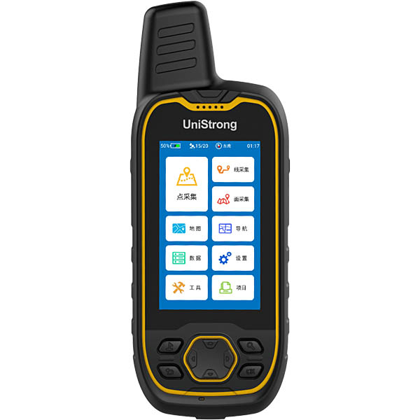
G138BD BeiDou Handheld Navigator
With the BeiDou system officially entering networked operation in 2012, GNSS satellite navigation ushered in the BeiDou era. UniStrong comprehensively upgraded its BeiDou G1 series handheld products, optimizing operational workflows, data organization formats, satellite navigation and positioning modules, systems, and mapping.
- 72
- Channels
- SBAS: 1-3m
- Positioning Accuracy
- IP67
- Dust & Waterproof
Original UniStrong unit·Authorized distributor
Overview
About the G138BD
With the BeiDou system officially entering networked operation in 2012, GNSS satellite navigation ushered in the BeiDou era. UniStrong comprehensively upgraded its BeiDou G1 series handheld products, optimizing operational workflows, data organization formats, satellite navigation and positioning modules, systems, and mapping. This ensures they meet the demands of users across various industries for data collection, area measurement, navigation, waypoint locating, and track recording, while also being well-suited for outdoor applications.
Specifications
With the official deployment and operation of the BeiDou system in 2012, GNSS satellite navigation entered the BeiDou era. UniStrong comprehensively upgraded its BeiDou G1 series handheld devices, optimizing workflows, data organization formats, GNSS positioning modules, operating systems, and mapping. This meets the needs of users across various industries for data collection, area measurement, navigation, waypoint recording, and track logging, while also serving outdoor applications.
G138BD High-Performance BeiDou/GNSS Handheld Terminal
● BeiDou/GPS/GLONASS satellite tracking ● Three power supply modes: AA dry cells, lithium battery, and USB ● Intelligent navigation map supporting contour line overlay ● Rugged industrial IP67 design ● Multiple coordinate system support ● Electronic compass and barometer
The G138BD supports three major satellite constellations—BeiDou, GPS, and GLONASS—providing fast and accurate positioning with superior performance in obstructed environments. Seamless Switching Between Three Power Supply Modes: Flexible switching among AA dry cells, rechargeable lithium battery, and USB power meets diverse field power requirements while effectively reducing operating costs. Multiple Coordinate System Transformations: Built-in support for over 100 domestic and international coordinate systems, including WGS84, CGCS2000, Beijing 54, and Xi'an 80, with flexible switching and simultaneous split-screen display of four coordinate systems for maximum convenience. Rugged Industrial Design: Featuring an IP67 protection rating and 1.5 m drop resistance, it is fully adapted to harsh field environments. Large Storage Capacity: 4 GB internal storage with support for up to 32 GB TF card expansion to accommodate massive data storage needs. Versatile Data Exchange Formats: Built on years of professional user insights, collected data can be exported into multiple standard GIS data exchange formats for seamless integration with GIS software, as well as export to Excel format. Turn-by-Turn Navigation Map with Contour Line Support: Built-in detailed navigation maps support intelligent turn-by-turn routing with rich point-of-interest (POI) attributes, including phone numbers and detailed addresses. Electronic Compass & Barometer: Standard built-in electronic compass and barometer support barometric altimetry for significantly improved elevation accuracy. Powerful Post-Processing Software: Equipped with GIS OFFICE desktop management software, supporting data viewing, editing, import, and export to streamline office data processing.
Specifications
Technical data
Values from the UniStrong datasheet. Ask us for the full sheet or a side by side with another model.
GNSS
- Satellite Tracking
- BeiDou B1, GPS L1, GLONASS L1, supports SBAS
- Channels
- 72
- Positioning Mode
- GPS / BeiDou / GPS+GLONASS / GPS+BeiDou
- Positioning Accuracy
- Single point: 2-5m
- Positioning Accuracy
- SBAS: 1-3m
- Update Rate
- 1Hz
Power
- Power Supply Type
- AA battery / Lithium battery / USB
- Battery Life
- AA battery: 8 hours
- Battery Life
- Lithium battery: 12 hours
Storage
- Internal Memory
- 4GB
- Storage Expansion
- Supports MicroSD card expansion, up to 32GB
Data Communication
- Data Communication
- Mini-USB data communication
- Data Interface
- Supports NMEA serial data output
Display
- Screen Size
- 2.4 inches
- Resolution & Type
- 240×320, sunlight-readable TFT
Environmental Protection
- Dust & Waterproof
- IP67
- Drop Resistance
- Withstands 1.5 m drop onto hard surface
- Operating Temperature
- -20℃~+60℃
- Storage Temperature
- -30℃~+70℃
Data Collection
- Waypoint Storage
- 3000
- Route Storage
- 60 routes
- Track Storage
- Unlimited tracks (depending on storage capacity), up to 10,000 points per track, 10,000 temporary track points
- Area Measurement
- Route + track + professional tools
- Navigation
- Straight-line navigation + along-road navigation
- Map
- National electronic navigation map, supports loading contour maps
Sensors
- Electronic Compass
- Supported
- Barometer
- Supported
Physical Specifications
- Dimensions
- 112mm × 68mm × 37mm
- Keys
- Power key, page key, map zoom keys, joystick navigation key
Related
All controllers and GISView all
Similar controllers and GIS
Get a quote
Get a quote for G138BD
Tell us how many units and where they ship. An engineer replies with price, lead time and freight within 24 hours.
- Reply within 24 hours
- Original units with serial numbers
- Local coordinate system preset
Reply within 24 h · Original units · Local datum preset