

Hi-Target
Business Center
Hi-Target Business Center HBC, the all-in-one post-processing desktop software, supports processing multi-sourced data from…
Authorized distributor of original survey instruments·Dispatch in 3 to 7 working days·DDP / CIF / FOB

BeyonServer Spatial Data Service System V2.0 (abbreviated as BeyonServer) is an OGC-compliant geospatial information service publishing and management tool developed by Beijing Boyang Shitong Information Technology Co., Ltd. It supports powerful features including map data publishing, map data access, map data visualization, and map style…
Original UniStrong unit·Authorized distributor
BeyonServer Spatial Data Service System V2.0 (abbreviated as BeyonServer) is an OGC-compliant geospatial information service publishing and management tool developed by Beijing Boyang Shitong Information Technology Co., Ltd. It supports powerful features including map data publishing, map data access, map data visualization, and map style customization. It publishes maps based on workspaces to facilitate data publishing and operational management, utilizes map tiling tools to significantly accelerate data access speeds, provides XML style file editing and validation tools for convenient style customization, and delivers standard OGC map service interfaces.
BeyonServer Spatial Data Service System V2.0 (BeyonServer) is an OGC-compliant geospatial information service publishing and management tool developed by Beijing Beyon Information Technology Co., Ltd. It provides robust capabilities including map data publishing, map data access, map data visualization, and map style customization. Map publishing is organized by workspace for streamlined data publishing and operational management. Integrated map tiling tools significantly accelerate data access speeds, while XML style file editing and validation tools facilitate style customization. It also provides standard OGC map service interfaces.
Spatial data publishing requirements are as follows: (1) Data Sources - Database types: BeyonServer Spatial Data Service System currently supports the BeyonDB 5.0 spatial database, and can also support databases such as ArcSDE, DB2, SQL Server, and MySQL via plugins. File data: Defaults to supporting vector formats such as Esri Shapefile and raster data formats such as GeoTIFF. (2) Coordinate Reference Systems: BeyonServer currently supports multiple coordinate systems, including Google-led coordinate systems widely adopted by major map service providers.
Data service management covers workspaces, layer groups, and functional management features such as map rendering and map caching. (1) Service Specification Support: The service management system supports standard OGC service specifications, primarily including WMS, WFS, WCS, WMTS, and WPS. (2) Map Rendering: Supports real-time map rendering for map access, dynamically switching rendering modes based on client request parameters. Anti-aliasing rendering is supported to enhance visual quality. Supports dynamic thematic map rendering, generating thematic images in real time based on client-defined styles, color palettes, scales, and other parameters. (3) Map Caching: Supports both dynamic map tiling and real-time map rendering for fast map access, dynamically switching rendering modes according to client request parameters. Supports multi-threaded map slicing to significantly boost tiling efficiency, accommodates multiple coordinate systems, and allows user-defined tiling levels and extents for flexible tiling schemes. Also supports publishing pre-rendered tile maps generated by ArcGIS. (4) Spatial Analysis: Currently supports WPS spatial analysis services to execute high-efficiency spatial analysis tasks with various built-in spatial analysis functions. (5) Layer Groups: Allows managing multiple map layers as a group, enabling multi-layer merging into a single layer. Clients only need to request this single layer group URL to retrieve a composite map, reducing client-side request overhead, enhancing performance, and delivering a superior user experience. (6) Server Tuning: When server workloads are light or only specific service types are needed rather than the full suite, users can dynamically enable or disable specific map services on the server. Allows dynamic control over disk storage quotas, disk block sizes, quota inspection frequencies, and maximum tile cache sizes. When the cache exceeds its quota, it can automatically purge the least frequently used (LFU) or
: Supports importing external symbol libraries, producing and exporting high-quality dynamic thematic maps. (2) Lightweight and Fast Map Service Publishing: Supports full SLD map styling specifications and rapid publishing of standard OGC services including map, catalog, feature, and spatial analysis services. (3) Efficient Map Caching Mechanism: Combines dynamic and static map caching mechanisms with multi-threaded map tiling. (4) Vector Tile Services: Supports real-time map rendering for map access, dynamically switching rendering modes based on client request parameters. (5) Multi-Source Spatial Data: Vector data: BeyonDB, Shapefiles; Raster data: TIFF/GeoTIFF (.tif), ERDAS Imagine (.img), etc. (6) Modular Functional Components: Supports convenient secondary development, customization, and extended product development.
Hi-Target Business Center HBC, the all-in-one post-processing desktop software, supports processing multi-sourced data from…
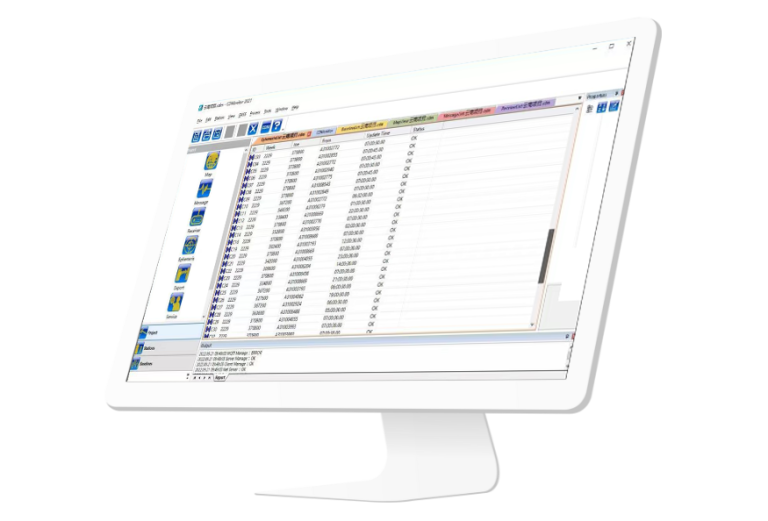
CDMonitor software is a professional deformation monitoring tool. lt can simultaneously perform real-time three-dimensional…
Tell us how many units and where they ship. An engineer replies with price, lead time and freight within 24 hours.
Reply within 24 h · Original units · Local datum preset