
UniStrong
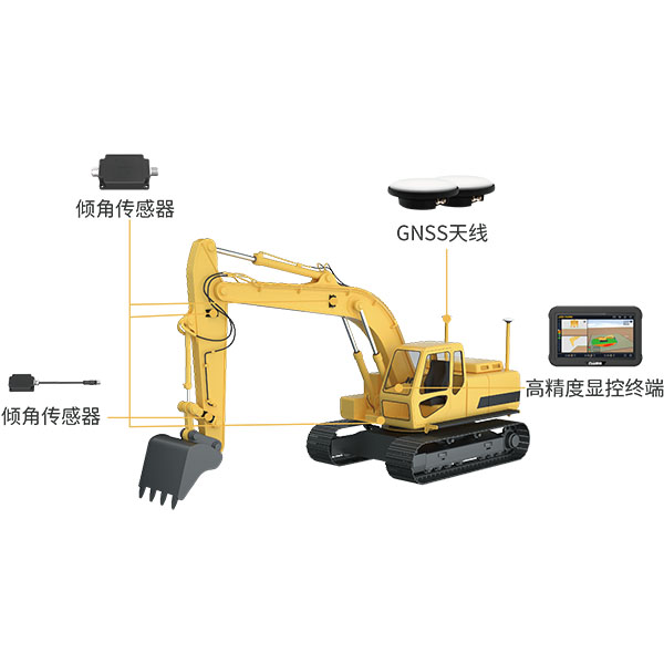
UES Intelligent Excavator Guidance and Control System
The system utilizes BeiDou/GNSS and multi-sensor fusion technology to provide real-time 3D guidance and…
Authorized distributor of original survey instruments·Dispatch in 3 to 7 working days·DDP / CIF / FOB
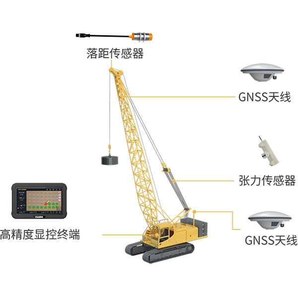
Utilizing BeiDou/GNSS and multi-sensor fusion technology, the system records and calculates blow counts, drop heights, compaction point positions, and settlement changes during operations, while storing, analyzing, and uploading the data. Project stakeholders, including owners, supervising engineers, and contractors, can log into the digital construction management…
Original UniStrong unit·Authorized distributor
Utilizing BeiDou/GNSS and multi-sensor fusion technology, the system records and calculates parameters such as blow count, drop height, tamping point location, and settlement changes during compaction operations, while storing, analyzing, and uploading the data. Project stakeholders—including owners, supervisors, and contractors—can log into the digital construction management platform for real-time data sharing, keeping abreast of construction quality, operational status, and project progress.
1. High-precision tamping point guidance allows operators to work according to layout requirements, supporting various construction methods such as soil replacement compaction and full-coverage tamping. 2. Two-way data communication with the digital construction management platform enables remote dispatching of construction tasks and visualized display of operational data. 3. Automatically identifies tamping points and records key data including blow count, drop height, and settlement without operator intervention, reducing manual operations. 4. Compatible with various brands, models, and types of dynamic compactors without system restrictions. 5. Unaffected by environmental conditions, it enables 24/7 day-and-night operations with automatic data collection and logging—even at night—preventing under-compaction, missed points, and dry blows. 6. Based on multi-sensor data fusion technology, it ensures accurate data recording, reduces the workload of on-site support personnel and supervisors, and enhances jobsite safety.
● Remote Supervision: Remotely monitors construction processes, quality, and progress, promptly detecting deviations, triggering alerts, and facilitating corrective actions. ● Data Reports: Generates construction result reports as an auxiliary tool for quality inspection and evaluation. ● Quality Monitoring: Real-time recording and transmission of critical process parameters ensure authentic, reliable data to guarantee compaction quality. ● Data Traceability: Automated end-to-end data acquisition, workflow routing, and electronic archiving facilitate data queries, statistical analysis, and decision support. ● Process Visualization: Visualized display of operational data with real-time tracking and playback of construction workflows provides an intuitive, comprehensive view of the jobsite.
Widely used in earthwork projects across civil construction, highways, railways, airports, ports, mining, agriculture, water conservancy, forestry, and defense infrastructure.
The system utilizes BeiDou/GNSS and multi-sensor fusion technology to provide real-time 3D guidance and…
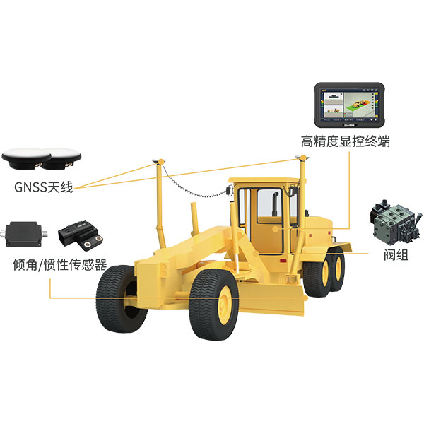
The system utilizes BeiDou/GNSS technology combined with sensors and hydraulic control devices to deliver…
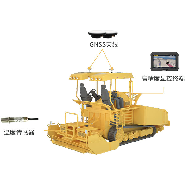
During paving operations, the intelligent paver guidance system utilizes BeiDou/GNSS equipment and infrared temperature…
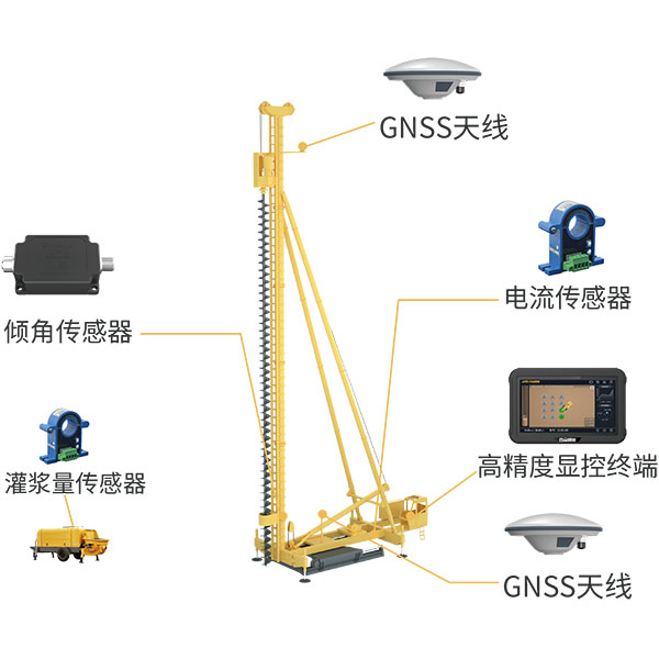
The system utilizes BeiDou/GNSS and multi-sensor fusion technology to obtain precise 3D position information…
Tell us how many units and where they ship. An engineer replies with price, lead time and freight within 24 hours.
Reply within 24 h · Original units · Local datum preset