
ComNav
Survey Master
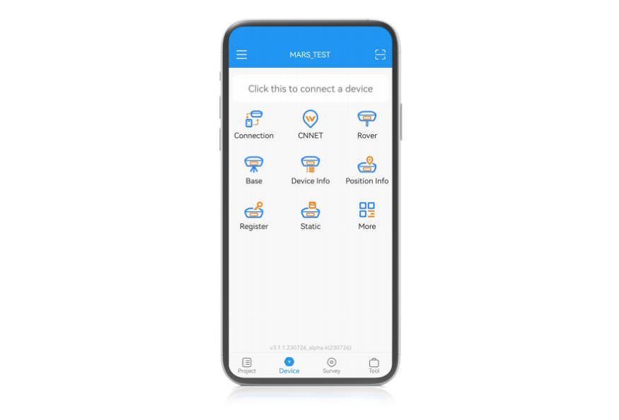
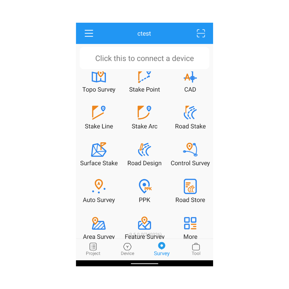
With Suvery Master you can survey through Topo survey/Auto survey, Static and PPK modes; edit and stake points/lines. Also this App provides a convenient way to import/export surveying data files, supporting data formats: TXT, CSV, SHP and AutoCAD DXF.
Original ComNav unit·Authorized distributor
Overview
About the Survey Master
- 01
Compatible with most of Android devices
- 02
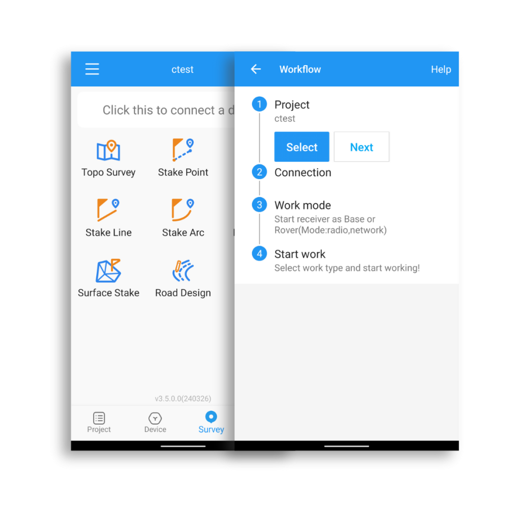
Easier survey workflow via Wizard function
- 03
Support up to 60° IMU tilt compensation
- 04
Support all survey modes, including Static, PPK and RTK
- 05
Support Surface Stake, Mapping Survey and etc. to serve various survey tasks
- 06
Support CAD import and directly use for stake out operations
- 07
Support Convert function from ComNavBinary raw file to RINEX
Ease of Use
Survey Master has a user-friendly design. Designed with an assistant function, new users can easily complete the entire survey workflow by following the assistant's steps. For professional users, Survey Master is equipped with numerous features to meet various survey tasks
High Compatibility
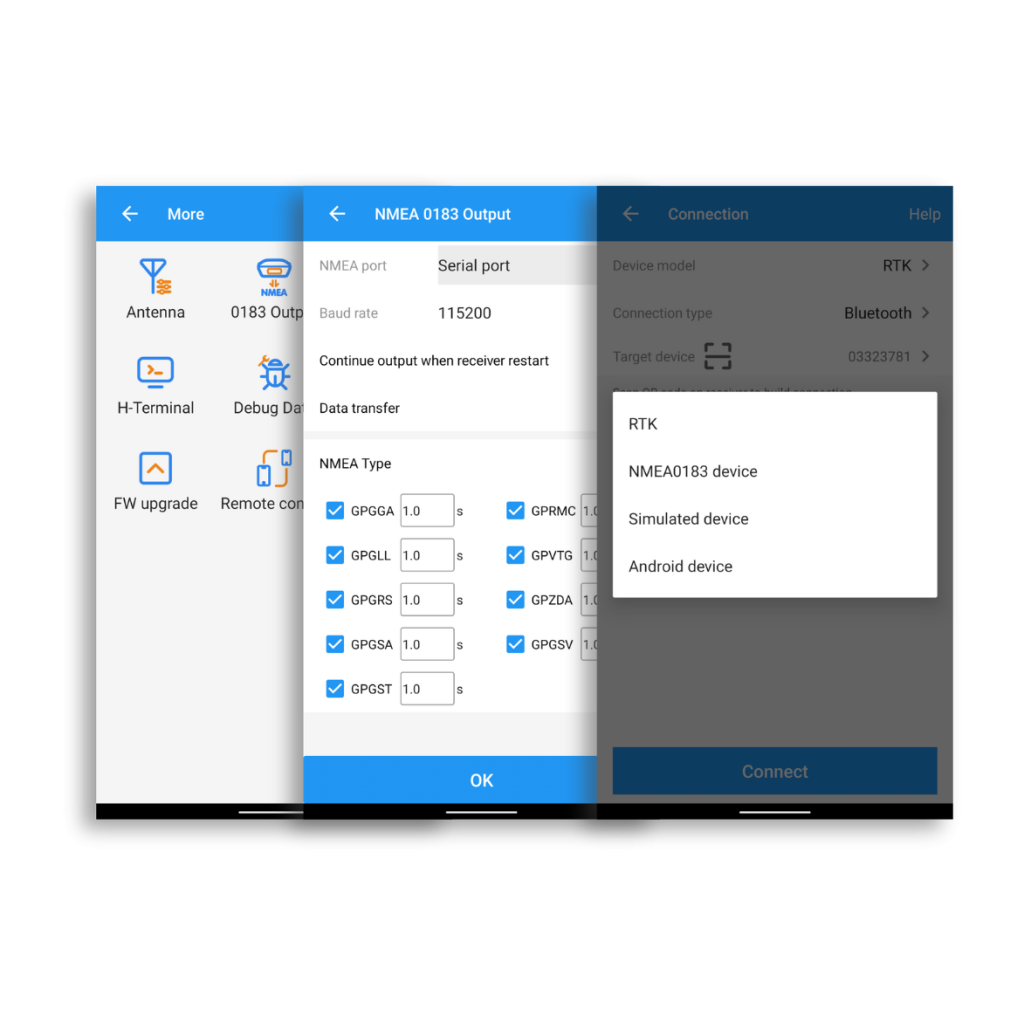
Developed with an Android structure, Survey Master is compatible with most Android-based devices, such as smartphones and data collectors. Additionally, with NMEA protocol support, Survey Master can be connected to GNSS devices that can output NMEA information
Abundant Functions
In order to work with most survey tasks and satisfy the requirements of users, Survey Master is designed with abundant functions for different work modes including RTK, PPK, static, and applications like road stake,surface stake, topo survey, feature survey and so on
Downloads
Datasheets and manuals
Free PDFs for the Survey Master. Need a manual in another language? Ask us and we will send it.
- SinoGNSS Survey Master_EN.pdfEN · PDF · 1.1 MB EN Download
Related
All softwareView all
Similar software

UniStrong
BeyonDB V5
Enterprise-grade, cross-platform, distributed, and highly secure database management system software with independent intellectual property…
- Specification
- Parameter
- Network Protocol
- Supports TCP/IP
- Clustering Modes
- Sharding, replication
Get a quote
Get a quote for Survey Master
Tell us how many units and where they ship. An engineer replies with price, lead time and freight within 24 hours.
- Reply within 24 hours
- Original units with serial numbers
- Local coordinate system preset
Reply within 24 h · Original units · Local datum preset